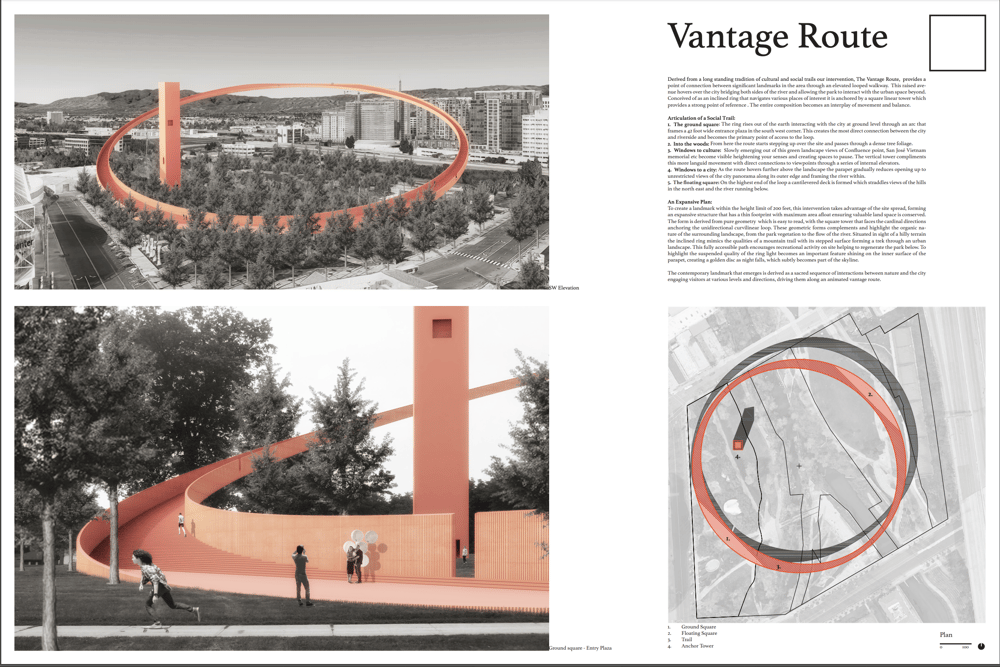
Derived from a long standing tradition of cultural and social trails our intervention, The Vantage Route, provides a point of connection between significant landmarks in the area through an elevated looped walkway. This raised avenue hovers over the city bridging both sides of the river and allowing the park to interact with the urban space beyond. Conceived of as an inclined ring that navigates various places of interest it is anchored by a square linear tower which provides a strong point of reference. The entire composition becomes an interplay of movement and balance.
An Expansive Plan:
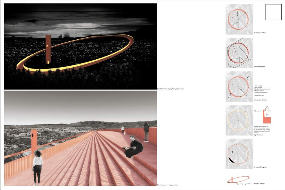
To create a landmark within the height limit of 200 feet, this intervention takes advantage of the site spread, forming an expansive structure that has a thin footprint with maximum area afloat ensuring valuable land space is conserved. The form is derived from pure geometry which is easy to read, with the square tower that faces the cardinal directions anchoring the unidirectional curvilinear loop. These geometric forms complement and highlight the organic nature of the surrounding landscape, from the park vegetation to the flow of the river. Situated in sight of a hilly terrain the inclined ring mimics the qualities of a mountain trail with its stepped surface forming a trek through an urban landscape. This fully accessible path encourages recreational activity on site helping to regenerate the park below. To highlight the suspended quality of the ring light becomes an important feature shining on the inner surface of the parapet, creating a golden disc as night falls, which subtly becomes part of the skyline.
The contemporary landmark that emerges is derived as a sacred sequence of interactions between nature and the city engaging visitors at various levels and directions, driving them along an animated vantage route.
The Social Trail:
1. The ground square: The ring rises out of the earth interacting with the city at ground level through an arc that frames a 42 foot wide entrance plaza in the south west corner. This creates the most direct connection between the city and riverside and becomes the primary point of access to the loop.
2. Into the woods: From here the route starts stepping up over the site and passes through dense tree foliage.
3. Windows to culture: Slowly emerging out of this green landscape views of Confluence point, San José Vietnam memorial etc become visible heightening your senses and creating spaces to pause. The vertical tower compliments this more languid movement with direct connections to viewpoints through a series of internal elevators.
4. Windows to a city: as the route hovers further above the landscape the parapet gradually reduces opening up to unrestricted views of the city panorama along its outer edge and framing the river within.
5. The floating square: On the highest end of the loop a cantilevered deck is formed which straddles views of the hills in the north east and the river running below.